Out Of Stock
-100 %
N.B. Image may differ with actual product's layout, color, size & dimension. No claim will be accepted for image mismatch.
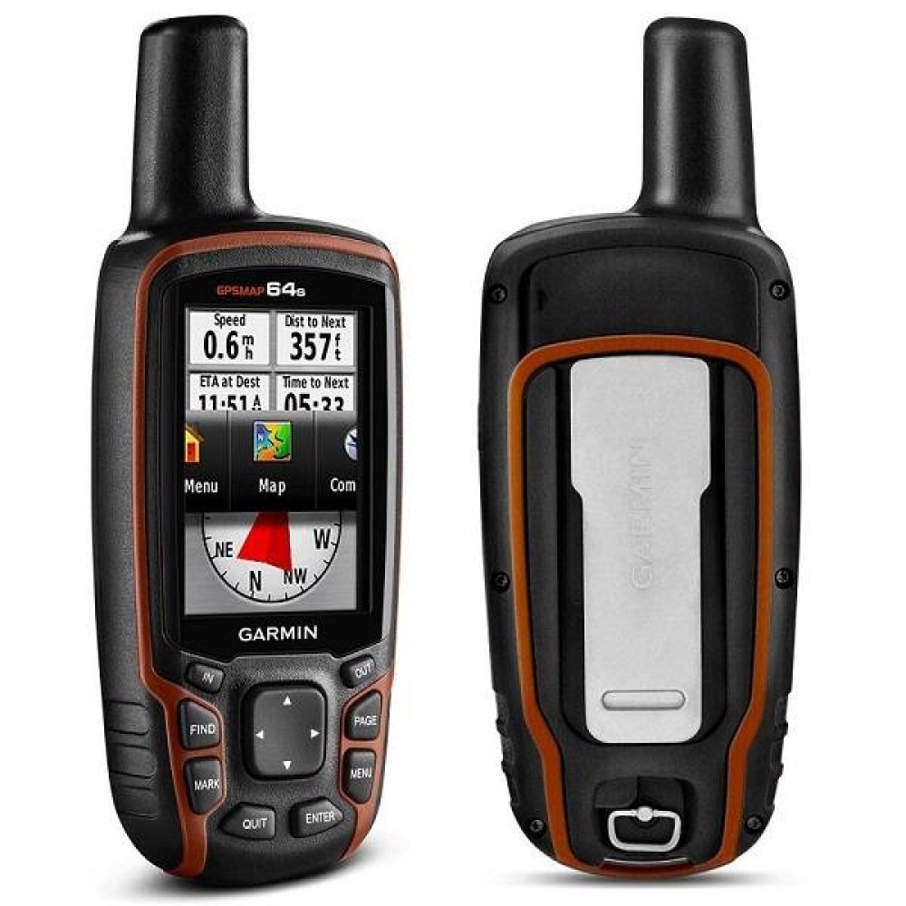
Garmin MAP64S Handheld GPS
- Brand: Garmin
- Model : MAP64S
- PID : 27911
Ex Tax: 36,500 ৳
i
Out Of Stock
Features
- Please confirm availability before completing your purchase by calling us.
- The actual product may vary in size, color, and layout compared to the website display images. Claims will not be accepted for image discrepancies.
- We reserve the right to change the price of any product at any time due to the volatile nature of technology prices.
- We cannot guarantee that the information on this page is 100% accurate. Multimedia Kingdom is not responsible for any results obtained from using this information.
Garmin MAP64S Handheld GPS
Garmin MAP64S Handheld GPS are available in Bangladesh at Multimedia Kingdom.To know more call 01755532348.
Specification
| Physical dimensions | 2.4" x 6.3" x 1.4" (6.1 x 16.0 x 3.6 cm) |
| Display size | 1.43" x 2.15" (3.6 x 5.5 cm); 2.6" diag (6.6 cm) |
| Display resolution | 160 x 240 pixels |
| Display type | transflective, 65-K color TFT |
| Weight | 8.1 oz (230 g) with batteries |
| Battery | 2 AA batteries (not included); NiMH or Lithium recommended |
| Battery life | 16 hours |
| Water rating | IPX7 |
| High-sensitivity receiver | Yes |
| Memory | 4GB |
| Interface | high-speed USB and NMEA 0183 compatible |
| Ability to add maps | Yes |
| Base map | Yes |
| Waypoints/locations/favorites | 5000 |
| Routes | 200 |
| Track log | 10,000 points, 200 saved tracks |
| Area calculation | Yes |
| Sun and moon information | Yes |
| Compass | Yes |
GPSMAP 64s comes with a built-in worldwide base map with shaded relief plus a 1-year Birds Eye Satellite Imagery subscription, so you can navigate anywhere with ease. With photo navigation, you can download geotagged pictures from the Internet and navigate to them.
GPSMAP 64s has a built-in 3-axis tilt-compensated electronic compass, which shows your heading even when you’re standing still, without holding it level. Its barometric altimeter tracks changes in pressure to pinpoint your precise altitude, and you can even use it to plot barometric pressure over time, which can help you keep an eye on changing weather conditions.

